Biodiversity / GRI 413-2, SDG 6.6, 11.4, 15.1, 15.5 /
|
Our 2024 targets |
Target achievement status |
Actions taken in 2024 |
Targets for 2025 |
|---|---|---|---|
|
Carry out monitoring of fauna, including population of rare and endangered species (river beaver). Carry out monitoring of ichthyofauna and its food potential (the Berezovka River and Konchubai gully). |
Completed |
|
Carry out the monitoring of fauna and laboratory analyses of soil and plants within the KOGCF. |
|
Continue flora and fauna baseline studies along the KATS route. |
In progress |
Flora baseline studies were carried out along export pipeline KPC – Bolshoi Chagan – Atyrau route in Atyrau Oblast. |
Carry out fauna baseline studies along the KATS export pipeline in WKO. |
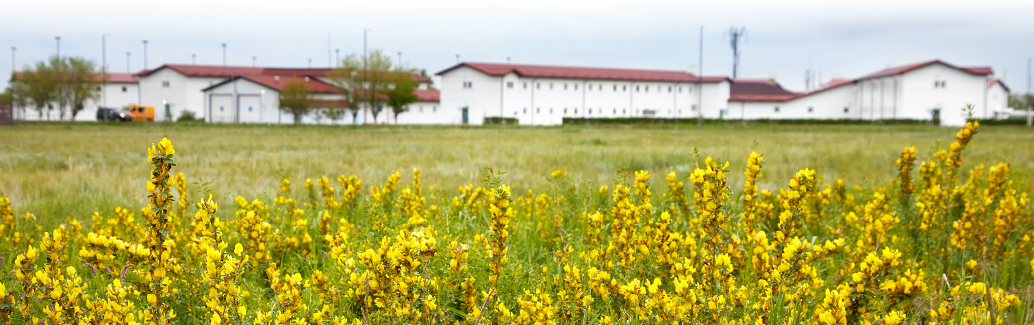
Karachaganak oil and gas condensate field (KOGCF) covers an area of more than 280 km2. KPO shares the single territory with other users of natural resources, while it operates only on areas directly located under industrial facilities, pipelines and field roads.
Besides the KPO industrial facilities, there are other businesses deployed at the Karachaganak Field, which are either engaged in processing of some part of the raw product produced by KPO (such as JSC “Condensate”) or provide maintenance services for the field and infrastructure facilities. Apart from KPO and third-party facilities, there are large areas in the field previously used as agricultural land and farming land plots. Until 1956 this area had been used for pastures and hayfields. After 1957, farmers started growing grain crops except the floodplains and slopes of the Konchubai and the Kalminovka gully, which remained as pastures. So far, the state reserve lands (SRL) prevail on the sanitary protection zone (SPZ) of the Karachaganak Field. However, some patches are still being used by farms.
Thus, the above factors create certain difficulties in identifying and delineating responsibility for potential negative impacts and often limit KPO ability to take practical actions for restoration of the environment and the biodiversity.
Nevertheless, KPO is aware that natural biodiversity is not subject to administrative and territorial divisions set up by humans and to preserve all the entire biological wealth of a certain territory and the fragile links in the chain of species interaction, all players must follow common principles and approaches. In this regard, Action of biological diversity within the contract areas is the subject of special attention by the Company.
KPO is aware that natural biodiversity is not subject to administrative and territorial divisions set up by humans and to preserve all the entire biological wealth of a certain territory and the fragile links in the chain of species interaction, all players must follow common principles and approaches.
Aiming to minimize impact on biodiversity in the Field, since 2012 KPO develops and implements the Biodiversity Action Plan (BAP) regardless that there are no particularly sensitive areas which require biodiversity monitoring. Biodiversity Action Plan is one of the measures used to prevent the disbalance of ecosystem and reduction of biodiversity; it’s a risk-based assessment of KPO’s presence in terms of its potential impact on environment.
BAP is developed in accordance with the IPIECA/OGP’s ‘BAP Instruction guidelines for Oil and Gas’ and updated every three years. Also, the survey and monitoring frequency is set at regular intervals. As part of the BAP, the Company has developed guidelines for actions recommended for sensitive ecosystems in riverbank areas, along with the flora and fauna species database. The database is updated yearly upon completion of surveys.
As part of the BAP, KPO performs an analysis of factors impacting the Field’s biodiversity.
Additionally, satellite images analysis is being conducted for KOGCF every 10 years to monitor the dynamics of changes in the ecosystems.
Export pipeline ‘Karachaganak-Atyrau’ (hereinafter as KATS) is one of the key facilities that support the Karachaganak field’s development. The pipeline was put in operation in 2004, and its length is 635,5 km. In 2022 for the first time ever KPO developed BAP 2023–2030 for the territory located along the KATS pipeline route.
In 2023 and 2024 KPO carried out flora baseline studies along KATS route for the purposes of:
- Identification of priority (key) species of flora;
- Identification of indicator species of flora;
- Identification of factors impacting ecosystems along the KATS route;
- Selection of site locations and routes for further monitoring;
- Creation of flora database.
The KATS route runs all the way through the West Kazakhstan and Atyrau Oblasts, KPO has therefore decided to carry out the region baseline studies on a phased basis.
MONITORING OF BIODIVERSITY AT KOGCF / GRI 304-2 /
For 2024 reporting period KPO has performed the approved activities, planned in BAP for 2024–2026.
All BAP stages since 2011 are uploaded on KPO website www.kpo.kz in the section Sustainable development /Environmental protection/Biodiversity / BAP.
The scope of work for 2024 included monitoring of fauna and ichthyofauna within the KOGCF, including laboratory studies on fish and shellfish from its water bodies.
The purpose of the monitoring was:
- obtaining data on terrestrial vertebrate species within the KOGCF in spring and autumn of 2024, comparing the data with previous studies.
- obtaining data on ichthyofauna and its food potential (plankton, and benthos) in the Berezovka River and Konchubai gully in 2024, comparing the data with previous studies. Berezovka River and Konchubai gully in 2024 and comparing the data with previous studies.
Fauna monitoring
The Field’s faunal complex belongs to the western steppe zoogeographical realm and has a distinctly steppe character.
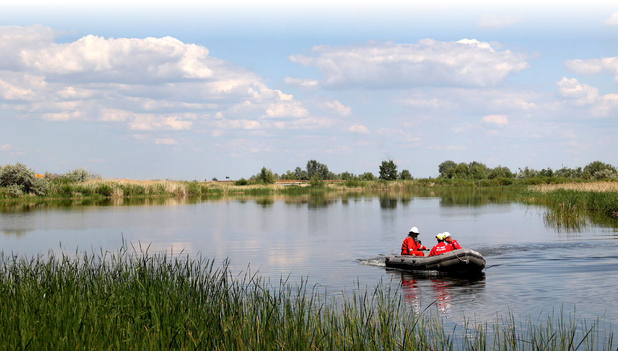
The field survey was conducted during the spring and autumn periods, within and outside the KOGCF SPZ boundaries, on 17 walking routes and 5 monitoring sites (considering the flood situation and the maximum filling level of water bodies).
2024 monitoring confirmed presence of the following species within the field and adjacent areas:
- 11 species of herpetofauna.
- 174 species of ornithofauna, of which 9 are listed in the Rok Red Book.
- 27 species of mammal fauna, of which 2 species are listed in the Rok Red Book.
No visible changes occurred in mammal species composition within the field and adjacent territories over the 2012–2024 period. At the same time, a significant number of wild boar (Sus scrofa) encounters were reported in the spring of 2024, which is due to the severe flood events. Additionally, in 2024 and 2021, a high population density of the Siberian roe deer (Capreolus pygargus) was observed.
Colonies of the European beaver (Castor fiber) are found in water bodies across the entire KOGCF and its SPZ territory. The population size and the area occupied by beavers depend on the water level in the water bodies. In the spring of 2024, the water level in most of the water bodies within the KOGCF and its SPZ significantly increased compared to the spring level of 2021. The rise in water levels triggered the migration of beavers and their settlement in previously abandoned old colonies in areas that had no water in 2021.
The results of the monitoring of wildlife (terrestrial vertebrates), as well as the analysis of population size and species diversity of fauna conducted during the spring and autumn periods of 2024, did not reveal any negative impact from the KOGCF industrial facilities on the faunal complex of the surveyed area.
The protective regime within the KOGCF creates favourable conditions for the development of fauna in areas not affected by the company’s activities. The industrial facilities’ operation is a source of disturbance for most animals. At the same time, large areas are preserved to provide habitat conditions for a significant number of species from the faunal complex. Currently, on the territory of the KOGCF, conditions have been created that are close to protected natural areas in a number of respects: livestock grazing, haymaking and hunting are not carried out, vehicle traffic is regulated, and there are no permanent human settlements. A significant area, covering various biotopes, is under in-house security.
Ichthyfauna monitoring
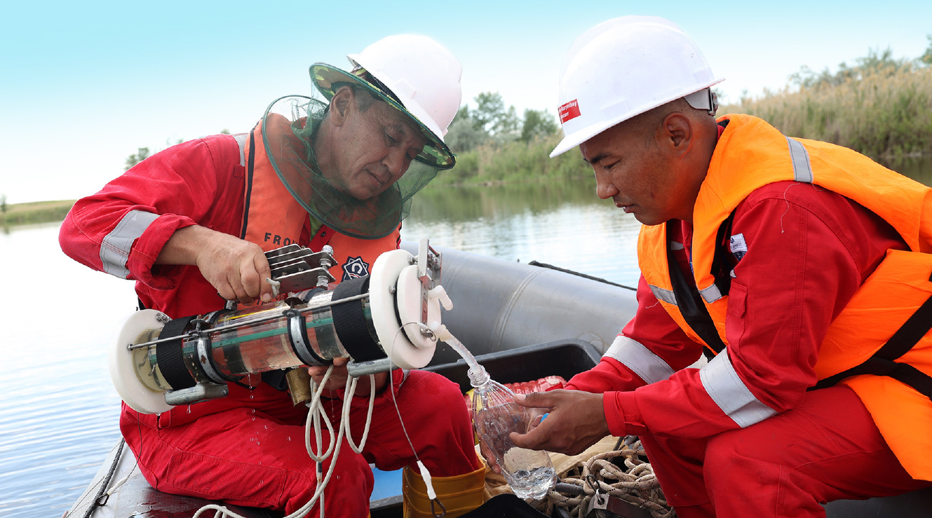
In 2024, second monitoring of ichthyofauna and its food supply potential (plankton, benthos) was carried out at selected sites of the KOGCF and its adjacent territory (Berezovka River and Konchubai gully) taking samples of tissues of aquatic organisms (fish, shellfish) and bottom sediments for chemical analysis.
Regular monitoring of ichthyofauna, plankton and benthos at selected monitoring sites on the KOGCF and adjacent territories allows to evaluate potential negative impacts from the production activities. The monitoring is conducted once every six years.
Compared to 2018, the species composition of ichthyofauna in 2024 remained largely at the same level.
In 2024, the levels of heavy metals in the tissues of fish and shellfish were below the limit at most sampling points. However, it is not possible to assess the accumulation of heavy metals in the tissues of shellfish from 2018 to 2024 due to insufficient data. For more accurate conclusions regarding the accumulation of pollutants and more objective assessment of the biological status of water bodies within the KOGCF territory, the studies will be continued.
Biodiversity Action Plan at KOGCF territory for 2024–2026
Along with conducted analysis of KOGCF and adjacent territories ecosystems’ dynamic pattern, a BAP for conservation of biodiversity at KOGCF territory for 2024–2026 was developed in 2023.
The BCP for 2024–2026 identifies main aspects of KPO activities on conservation of biodiversity in this region.
Tab. 48. Biodiversity Action Plan stages for 2024–2026
|
Period |
The Scope of Work |
Purpose |
|---|---|---|
|
2024 |
Fauna monitoring, studies of ichthyofauna and hydrobionts species diversity within KOGCF |
Determination of dynamic for fauna species diversity and population within KOGCF in comparison with the 2021 surveys. Determination of dynamic for ichthyofauna and hydrobionts species and population within KOGCF in comparison with the 2018 surveys. |
|
2025 |
Monitoring of flora and soil |
Study of vegetation condition. Perform of analysis for contamination in soils and plants. |
|
2026 |
Survey of insect species diversity within KOGCF |
Determination of dynamic for insect species diversity and population within KOGCF in comparison with the 2020 surveys. |
|
2024–2026 |
Creation and support of geographic information system |
Creation of a geographic information system on biodiversity |
Monitoring of biodiversity at KATS / GRI 304-2 /
During 2024 KPO has executed the pre-planned activities as part of the 2023–2030 BAP for the areas along the KATS export pipeline route.
The scope of work for 2024 along the KATS pipeline included baseline monitoring of flora along the KATS section located in Atyrau Oblast, including laboratory studies.
Baseline surveys of flora and vegetation along the KATS pipeline route within AO was conducted at various type points:
- points near water crossings;
- points designated to different ecosystems;
- points near monitoring stations as part of PEC.
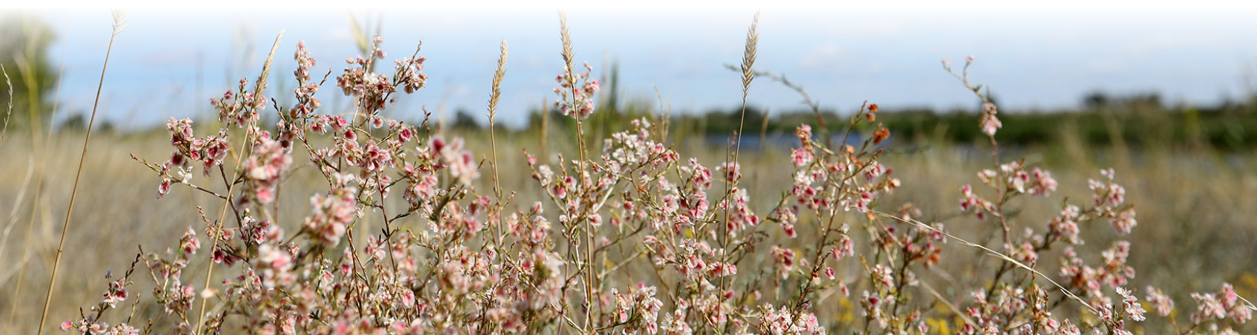
Total 36 points (sites) were surveyed, where 85 plant species belonging to 62 genera were registered. A baseline vegetation survey along the KATS pipeline route within the WKO identified flora and vegetation impacts such as transport, mechanical, agricultural and residential.
Of the factors listed above, KPO activities include transport and residential impacts. Residential impact is insignificant due to the fact that the transmission lines and block valve stations were built long ago, and only routine maintenance of these facilities is currently carried out.
The impact of transport on the ecosystems of the study area is the most significant of all the impact factors. It should be taken into account that not only KATS security service constantly inspects the pipeline, but also the security service of the Karachaganak-Uralsk high-pressure gas pipeline and the Uralsk-Atyrau-Samara oil pipeline, the pipes of which runs parallel to the KATS pipeline.
The mechanical factor was given separately due to the construction of dams and protective barriers during the flood period in May 2024, as earthworks were carried out to build flood control dams, leading to the disruption of the soil-vegetation layer. Since floods can occur every year, this factor should also be monitored.
There are a large number of settlements along the KATS pipeline route within the Atyrau Oblast (the closest to the KATS route are: Yeltai, Yntymak, Yesbol, Orlik, Koktogai, Oteshkali Atambayev, Kenoris, Aktogai, Makhambet, Zhalgansai) whose residents are engaged in agriculture and cattle breeding. Their activities affect the structure and condition of the herbaceous communities of the area used: pasture, haying, ploughing, fertiliser application, etc. In areas with no cattle grazing, the condition of the vegetation is satisfactory.
Total 36 points (sites) were surveyed, where 85 plant species belonging to 62 genera were registered.
During further flora monitoring along the KATS route, it is planned to track changes in the species composition (quantitative and qualitative indicators) of indicator and key plant species in communities affected by the agricultural impact factor.
According to the monitoring results along the pipeline, no disturbance of the vegetation cover was observed. The soil above the pipeline has been overgrown with native species in almost all areas, and in some places even small shrubs, subshrubs and bushes are present, indicating the restoration of the area.
During further monitoring, KPO will track the nature of ecosystem change under the influence of individual transport, mechanical, agricultural and residential factors and their combination, which, if necessary, will enable the development of measures to reduce the impact of different land users’ activities on the region’s ecosystems.
Laboratory tests were carried out to determine plants contamination by sampling from each monitoring site.
So far, it is difficult to make conclusions about the relationship between the content of pollutants in soils and plants due to lack of statistical data. The dynamics of pollutant levels in soils and plants will continue to be monitored with a frequency of once in 6 years, which will allow to collect statistical data and help determine the degree of impact or lack thereof on the ecosystems along the KATS pipeline.
As a result of the background studies, KATS flora database (Atyrau Oblast) was created.
The Biodiversity Action Plan (BAP) for 2023–2030 prepared for the territory located along the KATS export pipeline route, identifies main aspects of KPO biodiversity conservation activities in this region.
Tab. 49. Stages of the 2023–2030 BAP for the territory located along the KATS export pipeline route.
|
Period |
The Scope of Work |
Purpose |
|---|---|---|
|
2023 |
Baseline surveys for species diversity and vegetation condition along the KATS export pipeline section located in West-Kazakhstan Oblast |
Identification of priority (key) and indicator specie of flora and study their condition. Identification of factors impacting ecosystems along the KATS route. |
|
2024 |
Baseline surveys for flora condition along the KATS section located in Atyrau Oblast |
|
|
2025 |
Baseline surveys for fauna species diversity along the KATS section located in West-Kazakhstan Oblast. |
Identification of priority (key) and indicator species of fauna and study of their population status. Identification of factors impacting ecosystems along the KATS route. |
|
2026 |
Baseline surveys for fauna species diversity along the KATS section located in Atyrau Oblast. |
|
|
2027 |
Creation of a geographic information system on biodiversity along the KATS pipeline route |
Introduction of KATS pipeline route’s biodiversity information into the KPO GIS |
|
2028 |
Monitoring of the soil and vegetation cover along KATS section, located in West Kazakhstan Oblast |
Identification of the pasture impact on soil and vegetation cover state |
|
2029 |
Monitoring of the soil and vegetation cover along KATS section, located in Atyrau Oblast |
Key species control
As part of biodiversity assessment, KPO makes a considerable focus on monitoring of rare plant and animal species. The priority of a particular species in matters of biodiversity conservation is determined by the priorities of international and local legislation, sensitivity and resistance to impacts and significance of possible negative impact of the company activities on the environment.
The main key species considered during the research period from 1990 to 2023 are shown on the website www.kpo.kz in the section Sustainable development/ Conservation of biodiversity/Significant species of flora and fauna registered at KOGCF area.
All these species also exist outside the KOGCF. It should be noted that presence, absence or number of these species within the field is not a direct indicator of environmental well-being of the area. The distribution of individual species may change due to both local and global causes (climate change, desertification, etc.) that are not related to KPO activities. At the same time, it is necessary to plan and organize production activities in a way not to cause any direct and indirect effects on the population of individual species, which are an important part of the biodiversity at the Karachaganak Field and adjacent areas.
As part of biodiversity assessment, KPO makes a considerable focus on monitoring of rare plant and animal species.
In 2023 and 2024, during the baseline surveys performed along the KATS export pipeline route within WKO boundaries, five species of flora included in the Red Data Book of the Republic of Kazakhstan and the list of endangered species were registered:
Within WKO boundaries:
- Carnation andrzejowskianus (Dianthus andrzejowski)
- Woodland tulip (Tulipa biebersteiniana)
- Schrenck’s tulip (Tulipa shrenkii)
- Fischer’s star of Bethlehem (Ornithogalum fischeranum).;
- White water lily (Nymphaea alba).
Within AO boundaries:
- Schrenck’s tulip (Tulipa shrenkii)
The category of key / priority species includes the species whose study and protection are of high priority for the area. First, these are species listed in the Rok Red Data Book, IUCN Red List, as well as species that are rare or sparsely distributed in the area, they are the most vulnerable, quickly react to changes in habitat conditions and, thus, show indicator properties, in this regard, key species should be monitored.
CASE STUDY:
Oil spill response methods Net Environmental Benefits Analysis
Issue short description:
Hydrocarbons production, processing and transportation operations always imply a certain probability of emergency situations associated with deviation from specified production characteristics. One of the elements of preparedness to respond to situations that differ from the normal operation of oil and gas fields is the development of a system for early planning of actions aimed at both preventing and eliminating any emergency situations.
Considering that KPO’s in-field and export pipelines intersect with various inland bodies of water located in the territories of the West Kazakhstan and Atyrau regions, the company carefully plans the actions that will be taken in the event of accidents on these pipelines by developing and maintaining Oil Spill Response Plans.
One of the elements of oil spill preparedness planning is the early selection and assessment of optimal oil spill response methods based on the Net Environmental Benefit Analysis (hereinafter referred to as NEBA).
Currently, several by-laws have been introduced in the Republic of Kazakhstan, the requirements of which are aimed at determining the procedure for selecting, coordinating and making decisions on NEBA.
Guided by the requirements of the Republic of Kazakhstan regulatory acts and following the practice of continuously improving the quality of environmental management of production activities, KPO conducted research in 2024. This resulted in the Republic of Kazakhstan Ministry of Ecology and Natural Resources Committee for Environmental Regulation and Control approving a report on optimal methods for oil spill response based on the net environmental benefits analysis of KPO’s main and in-field pipelines.
The above report will be part of KPO’s Oil Spill Response Plans.
Objective:
The range of issues included in the analysis varies significantly from country to country. In Kazakhstan, these issues are regulated by the «Rules for determining, approving and deciding on the choice of optimal methods for oil spill response at sea, inland waters and in the protective zone of the Republic of Kazakhstan based on the Net Environmental Benefits analysis» dated 09/02/2021 №353.
NEBA is used in planning actions in case of an emergency oil spill, as well as during response activities, when NEBA is used to ensure correct understanding of the prevailing conditions. By choosing the optimal oil spill response (OSR) methods in advance, it is possible to ensure a comprehensive study of OSR methods for various scenarios, considering the impact of each method on environmental components.
Decisions / actions:
The International Association of Representatives of the Oil and Gas Industry on Environmental and Social Issues highlights that there is no single tool or methodology of NEBA suitable and or universally be acceptable in all situations, due to the wide range and scale of possible oil spills scenarios, various conceptions about the value of environmentally sensitive areas and socio-economic facilities, as well as the real conditions at the oil spill response site.
The NEBA process provides an assessment of the potential environmental impact sufficient for the parties to compare and select preferred combinations of oil spill response methods.
Due to the fact that various natural and technological factors can cause oil spillage into water bodies, the NEBA report considers full transverse rupture of the pipeline at all areas at intersections as the worst possible scenario.
Results:
The NEBA report provides assessment of information on the natural environment, flora and fauna adversely affected by emergency oil spills, the possibilities and limitations of OSR methods, in order to minimize the harmful effects on the environment in the event of potential occurrence of emergency oil spills at the intersections of in-field pipelines and KATS export pipeline with various inland bodies of water located on the territories of West Kazakhstan and Atyrau regions.
The report examines eight scenarios of emergency oil and condensate spill at the water crossing sites: for KATS – three sections of crossings over the Zhaiyk, Barbastau and Kursai rivers, for in-field pipelines – one area of crossing over the Berezovka River. The matrices have been developed to select optimal OSR methods with mitigation indicators, taking into account territorial, climatic and other conditions of KPO.
The report identified areas of operational measures for application of certain oil spill response methods, as well as the time and period of these measures application. For each spill scenario, a separate concept of operational measures was evaluated with identified optimal methods.
NEBA was approved by the state regulatory body, the Republic of Kazakhstan Ministry of Ecology and Natural Resources Committee for Environmental Regulation and Control.
If the conditions and scenarios of oil spill provided for by the KPO Emergency Oil Spill Response Plan do not coincide with the actual conditions of the oil spill, then the decision on the admissibility of the use of chemicals or controlled combustion of the oil spill is considered promptly by the state authorized body in field of environmental management based NEBA.
/ GRI 3-3 /
As an international oil and gas company, KPO makes great efforts to perform operations with minimal impact on biodiversity.
Since 2012, KPO has been monitoring the biodiversity to define the level of potential risks from its operational activities. In case of evidences that the Company’s activities are having a significant impact on the environment in the West Kazakhstan region, the former would initiate monitoring to timely plan and implement activities required to preserve the ecosystems.
As part of the Biodiversity Action Plan, KPO carries out an assessment of the four main factors impacting the KOGCF biodiversity:
- Pollutant emissions;
- Physical impact (noise, light, vibration);
- Cattle grazing at KOGCF area;
- Mechanical impact (construction, pits, roads, etc.).